Ali Ahmed and Sandra Cooke
University of Toronto, Canada ali.2529.ahmed@gmail.com, sandra.cooke@rogers.com
Introduction
This paper reports contexts of the Credit Indian Mission (1826-1847), a cultural landscape of the Mississauga First Nation, which is largely unrecognized and inaccessible on present day Mississaugua Golf & Country club site.
This paper proposes a set of landscape design interventions, aimed at reclaiming the cultural landscape of the Mississauga First Nation at the Credit Indian Mission by recovering their ancestral landscape, strengthening connections to their heritage while increasing public awareness about their heritage and culture. This paper envisions a spiritual journey for the Mississauga First Nation by renewing their identity to this cultural landscape.
Background
First Nations[1] of Canada are in this country before the European settlements, and the Mississauga First Nation came first in most of the southern Ontario. This paper graphically represents major settlements of the Mississauga First Nation over time in figure ‘1’. Figure ‘1’ also includes selected historic maps, heritage research findings and treaties.[2] Treaties were legal formalities to accommodate the European settlers in First Nation lands, the lands in which they developed a strong spiritual connection and passed meanings from one generation to the next.
“For many aboriginal people, the landscape in which they live is a seamless fabric of physical, spiritual and cultural threads”.[3] During the European colonization, First Nation people were pressured to integrate into an alternative lifestyle.[4]Subsequent European settlements were lacking understanding of First nation people, their culture, land and unique relationship to them. European settlements, oppressions and consequent circumstances caused the Mississauga First Nation to relocate in Hagersville, Ontario, leaving behind the Credit Indian Village, their last foothold in greater Toronto area.
About the Credit Indian Village
In the 1820s, the Mississauga First Nation risked extinction.[5] At this critical period, Mississauga First Nation Reverend Peter Jones took the leadership, who inherited education and Christianity through his father and First Nation culture from his mother. The Credit Mission Indian village was built in 1826 as per agreement between Peter Jones and the Government. Over two hundred people of the Mississauga First Nation moved to this village, which described as: “an elevated plateau, cleared of wood, and with three rows of detached cottages, among fields surrounded with rail fences”. The first nation was exceptionally prosperous in this village although in lasted only about 20 years.6
Presently in this cultural landscape, the golf club, its current programs and the surrounding neighborhood are limited to the elite community. The ancestral heritage and cultural bond to this landscape have disappeared and/or remain buried. Important spiritual aspect of the First Nation culture, the relationship between the dead and the living has been severed; their identity to this landscape has been lost.
The site and contexts review
Mississaugua Golf & Country Club (MGCC) is a 240 acres property located on the Credit River Valley, near the Mississauga Road interchange of the Queen Elizabeth Way (QEW Highway). QEW is about 2 km away from the mouth of the river (Lake Ontario). Another golfing facility, the Credit Valley Golf and Country club, shares the boundary with MGCC at the west.
The Credit River was catalyst of original settlements. Natural areas and public accessibility along the river valley corridor became fragmented and limited in the areas of two golf courses. Not only the two golf courses disrupt the flow of species along the river and valley corridor, restricting their movement to narrow ribbons of vegetation along the course margin, but the ability of the floodplain to function ecologically as it would it its natural state, is compromised.[6]
Considering the land ownership being a key factor of limiting the public accessibility and compromising ecology, this paper identifies nodes that include public accessible existing infrastructures along the river valley from its mouth at Lake Ontario to small islands adjacent to the MGCC site (figure ‘2’). These islands are in closest proximity of the existing unmarked First Nation burial ground, giving it particular significance for design intervention, without causing interference to active golf programs. Other significant nodes along the same valley corridor include:
- Hydro corridor – where the QEW bridge expansion work is in progress
- Trail off the Stavebank Road
- Indian Road and Mineola Road ends near the river
- Memorial park trail near Railway Bridge.
This paper recognizes existing infrastructures at the mouth of the river as a potential gateway of connecting the site with the larger regional network of waterfront trails.
Why it is important to recover this cultural landscape
In Anishnaabeg[7] culture, there is an ongoing relationship between the Dead and the Living; between ancestors and descendants. It is the obligation of the Living to ensure that their relatives are buried in the proper manner and in the proper place and to protect them from disturbance or desecration. Failure to perform this duty harms not only the Dead but also the Living.[8]
Neglect and inappropriate development put our irreplaceable landscape legacy increasingly at risk. It is everyone’s responsibility to safeguard our nation’s cultural landscapes. The ongoing care and interpretation of these sites improves our quality of life and deepens a sense of place and identity for future generations.[9]
Proposal
This paper proposes a set of landscape design interventions (based on contexts review and identified objectives as outlined in figure 3), aimed at reclaiming the cultural landscape of the Mississauga First Nation at the Credit Indian Mission. Concept of the proposal is emphasized on:
- History – Mississauga First Nation’s culture & heritage
- Education – public awareness
- Ecology – social and environmental
- Combination/Sustainability – integration of the history, education and ecology aiming towards achieving social and ecological sustainability.
Proposed interventions recognize and address local site issues, identify the main design objectives as:
- Recover/exhibit Heritage
- Facilitate place for cultural/spiritual celebration
- Bridge the connection (physical and spiritual) • Enhance ecology (social and environmental)
- Increase public awareness.
To achieve the objectives, scope of the proposal includes design features in identified nodes along the river valley from its mouth at the Lake Ontario to the small island in MGCC site. The paper also envisions a desire line and optimistic about future dialogs between the stakeholders for an access path to the cemetery. Major programs proposed and graphically represented in Trail Network Plan (figure 4) and Gathering/Celebration Site Plan (figure 5) include:
- Canoe route from the mouth of the Credit River to the Gathering/Celebration Site
- Trail off Memorial park to the Gathering/Celebration Site
- Trail and tall grass parks in Hydro corridor
- Vegetation enhancements
- Ceremonial Circles
- Memorial mound
- Interpretative signage and view points
Gathering/Celebration Site Plan
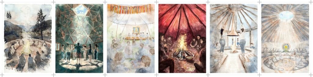
First Nation culture related features, symbols and materials (figure 3) have been included in this proposal.[10] For instance, concept of the Gathering/Celebration circle symbolizes Medicine wheel; vertical poles symbolizes excessive logging/encroachment by the European settlers as well as ring of vertical poles emphasizes the visual legibility of this cultural landscape from a distance.
Proposed programs would enable the First Nation to reconnect with their ancestors, perform ceremonies and renew their identity to this landscape. The paper imagines this as a spiritual journey for the First Nation that begins at the mouth of the Credit River by canoe and/or on foot by trail off the Memorial Park, through water and sacred islands. Access to the islands between QEW Bridge and Railway Bridge would provide opportunities to experience rare marsh land species and symbolizes Hunting and Fishing Rights of the First Nation. Nature walk to these marshlands would be off limit to general public.
First Nation, spiritual journey continues through the trail, underneath the QEW Bridge, ramp up and meets trail through proposed tall grass park off the Mississauga road; a bridge off the valley slope connects to the Celebration/gathering Island. Journey by canoe continues through landing dock at the north side of the river, then on boardwalk and bridge to the Celebration/gathering
Island. Trail off Stavebank road at Hydro corridor connects to the boardwalk below. Trail off Stavebank and Hearthwood Court continues through the woodland and connects to the Celebration/gathering Island.
During the journey First Nation could collect required gifts (sage, tobacco, sweet grass and cedar); from the woodland, men could bring in cedar sapling, build sweat lodge and perform ceremonies on the island nearest to the burial ground of their ancestors.[11]
References
City of Mississauga base map (Cad/GIS data). (Map and Data library, University of Toronto, 2012).
Dieterman, Frank (ed.). Mississauga : The First 10,000 Years. (Mississauga Heritage Foundation and Eastendbooks Toronto: 2002).
Howitt, Richard. Rethinking Resource Management : Justice, Sustainability and Indigenous Peoples.( New York: Routledge, 2001).
Johnston, Darlene. The History of Aboriginal Burial and Heritage Sites. (Report of the Ipperwash Inquiry – Volume 2.2005).
Rogers, Edward and Smith, Doland. Aboriginal Ontario: Historical Perspectives on the First Nations. (Toronto, Oxford: Dundurn Press, 1994).
Regional Municipality of Peel. Credit river coastal marshes. (Regional Municipality of Peel, Brampton 2012).
Unger, Marina and Spielmann, Roger. Towards a Model of Co-Management of Provincial Parks in Ontario. (Canadian journal of native studies 20.2: 455, 2000).
Wilkinson, Matthew & Heritage Mississauga. A Lost Village: The Credit Indian Village. (Personal correspondence, 2012).
[1] Various aboriginal people in Canada are known as the First Nation.
[2] Rogers and Smith, 1994
[3] Howitt, 2001
[4] Unger and Spielmann, 2000
[5] Dietman, 2002
[6] Regional Municipality of Peel, 2012
[7] A collective term that refers to Ojibway, Odawa and Algonkin people
[8] Johnston, 2005
[9] The Cultural Landscape Foundation- http://tclf.org/landscapes/what-are-cultural-landscapes
[10] Case studies: Freedom Park – Pretoria, South Africa, National heritage and monumental site; The Forks – Winnipeg, Canada, National historic site; and The Spirit Garden – Thunder bay, Canada.
[11] Part of the design concept embedded culture specific knowledge obtained through personal communication with Carolyn King at Mississaugas of the New credit First Nation reserve, Hagersville, Ontario.